


Software
OpenRoads: The Next-Generation Transportation Design Software for Roads, Highways, and Bridges

OpenRoads: The Next-Generation Transportation Design Software for Roads, Highways, and Bridges

OpenRoads is a software used for the design and analysis of transportation infrastructure projects such as roads, highways, bridges, and tunnels. It is a comprehensive solution that provides a wide range of capabilities for the planning, design, construction, and maintenance of transportation infrastructure.
Many users have found OpenRoads to be a useful software for transportation infrastructure projects. It is designed to improve design productivity and collaboration, allowing teams to work more efficiently and effectively. It also offers advanced features such as 3D modelling, which can improve design accuracy and visualization. It can also be used to evaluate the impact of different design options, allowing for the identification of the most cost-effective and efficient solutions.

Some of the useful features of the software include:
- Survey Data Processing: OpenRoads can be used to process and analyse survey data, including support for various data formats and the ability to create detailed maps and diagrams of the project.
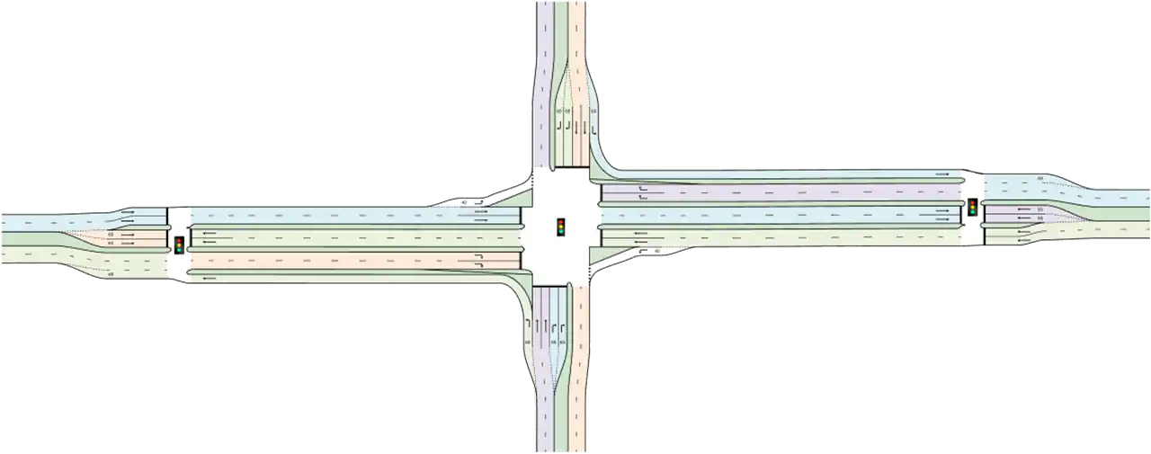
- Alignment Design: OpenRoads provides tools for the design of road alignments, including the ability to create, edit and analyse 2D and 3D alignments, and the ability to evaluate the impact of different design options.
- Terrain Modelling: OpenRoads can be used to model terrain, including the ability to create and edit digital terrain models (DTMs) and the ability to analyse the impact of terrain on the design of the project.
- Drainage Design: OpenRoads provides tools for the design of drainage systems, including the ability to create and analyse catchment areas, and the ability to design and analyse drainage structures such as culverts and stormwater management systems.
- Construction Documentation: OpenRoads can be used to create and manage construction documentation, including the ability to create and edit construction drawings, and the ability to generate cut and fill volumes and quantities.
- 3D Modelling: OpenRoads provides tools for 3D modelling, including the ability to create and edit 3D models of the project, and the ability to visualize and analyse the design in 3D.
- Integration with Other Software: OpenRoads allows for easy integration with other software such as GIS, BIM and other Bentley software, to import and export data, and to create detailed maps and diagrams of the project.
- Collaboration and Workflow Management : OpenRoads provides tools for workflow management and collaboration, allowing teams to work more efficiently and effectively and to share data and collaborate on the design and construction of the project.

The software is known for its ability to integrate various design and analysis functions, including survey data processing, alignment design, terrain modelling, drainage design, and construction documentation. OpenRoads also allows for easy integration with other software, such as GIS and BIM, to import and export data and create detailed maps and diagrams of the project.
OpenRoads includes advanced analysis capabilities, such as stormwater management and drainage design, as well as tools for construction modelling and simulation. This allows users to not only design their transportation projects, but also analyse and optimize them for construction, operation, and maintenance.


One of the main benefits of OpenRoads is its ability to improve productivity and reduce costs. By providing a comprehensive and integrated solution, users can streamline their workflow and avoid the need for multiple software programs. Additionally, with the ability to simulate and analyse construction scenarios, users can identify potential issues before they occur, minimizing the need for costly changes and delays.
OpenRoads supports BIM (Building Information Modelling) workflows. BIM is a process that involves creating and managing digital representations of physical and functional characteristics of a project. This allows for better collaboration and coordination among different teams and stakeholders, as well as improved communication and documentation throughout the project. OpenRoads also supports the use of 3D models for construction and asset management. This allows for better visualization and communication of design intent, as well as improved quality control and asset management during construction and operation.
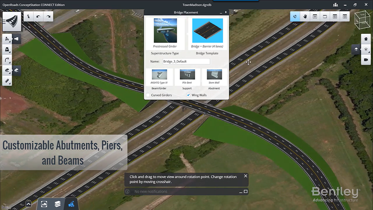
OpenRoads also offers a range of modules to support specific workflows, such as OpenRoads Designer for corridor design and modelling, OpenRoads ConceptStation for early-stage design and feasibility studies,
The key features of OpenRoads ConceptStation include:
- Conceptual design: The software provides tools for creating and evaluating different road design concepts, including alignment, profile, and cross-section design.
- Visualization: OpenRoads ConceptStation provides 3D visualization capabilities, allowing designers and stakeholders to see and evaluate road designs in a realistic and interactive environment.
- Collaboration: The software enables collaboration between designers, stakeholders, and reviewers, allowing for an efficient design process.
- Integration with GIS data: OpenRoads ConceptStation can import and integrate geospatial data from GIS systems, allowing designers to view and analyze road design data in a geospatial context.
- Data management and reporting: The software provides tools for managing and reporting on road design data, including the ability to generate reports and charts.
- Integration with other Bentley products: OpenRoads ConceptStation integrates with other Bentley products, such as MicroStation and ProjectWise, providing a streamlined workflow for road design and delivery.