Software
AL & ML ContextCapture
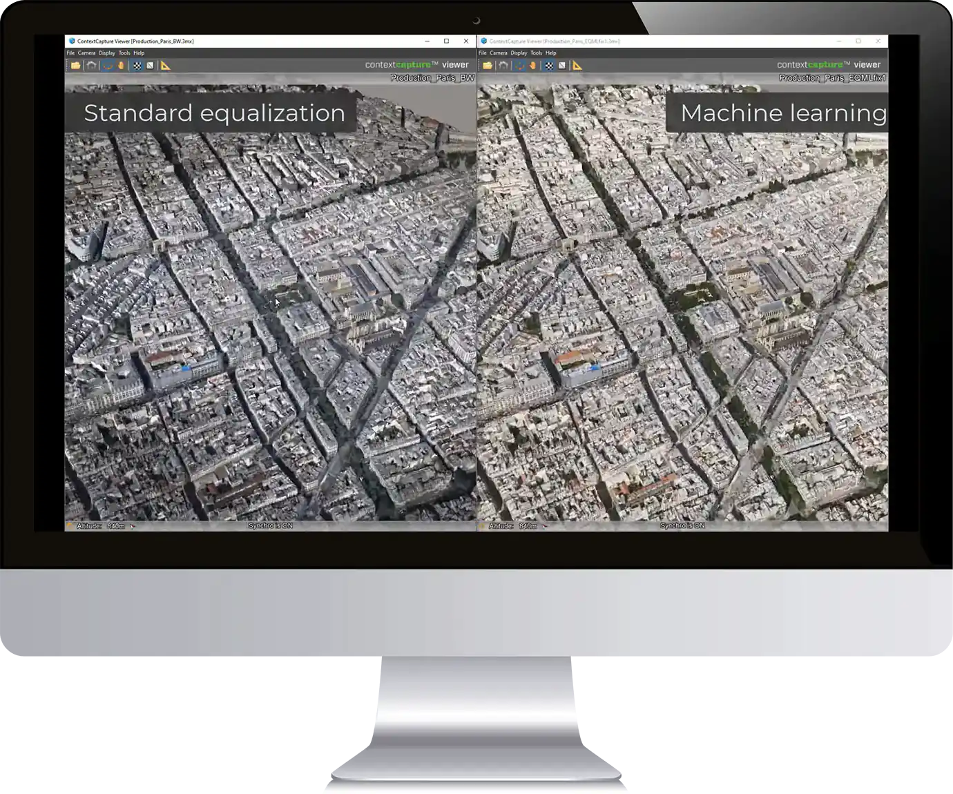
ContextCapture software leverages artificial intelligence (AI) and machine learning (ML) to automate and streamline the photogrammetry process, which is the process of creating accurate 3D models from photographs. Whether used by surveyors, engineers, architects, or GIS professionals, ContextCapture is an essential tool for anyone who needs to create accurate 3D models from photographs.
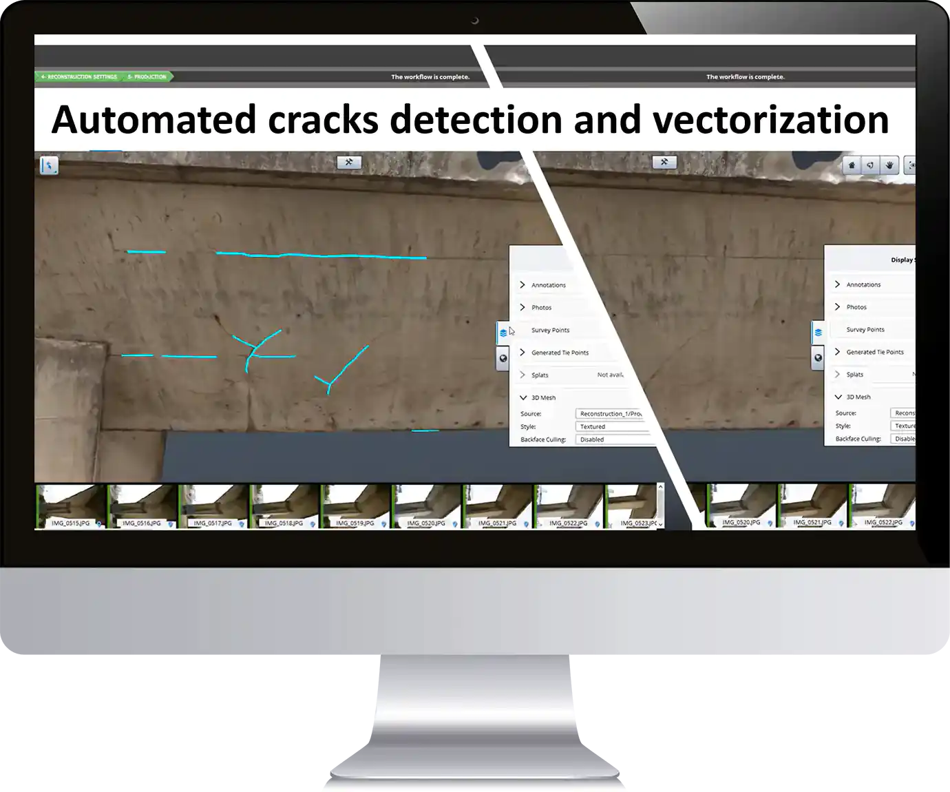
Here are some examples of how the software uses AI:
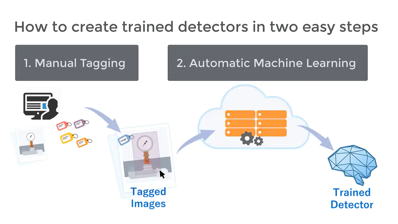
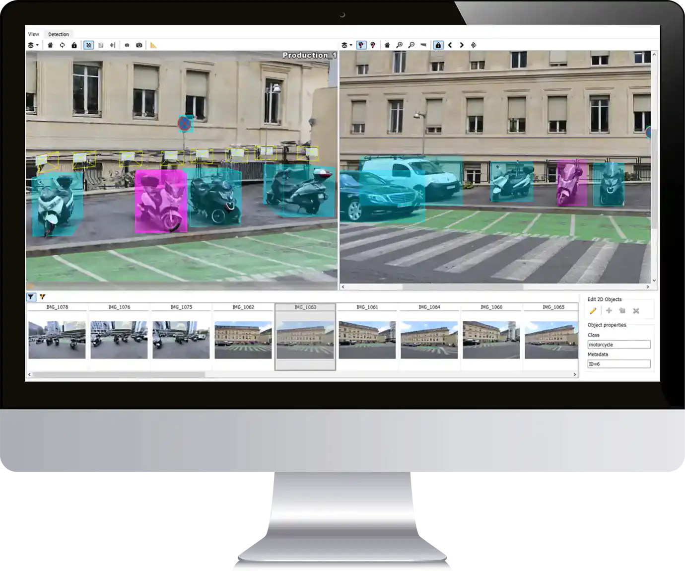
- Automatic Object Recognition: ContextCapture uses AI algorithms to automatically recognize and identify objects in photos, such as buildings, trees, and roads, which saves time and improves the accuracy of the model.
- Image-Based 3D Modeling: ContextCapture uses AI-based algorithms to create 3D models from photos, without the need for manual intervention. The software automatically processes the images, identifies common points, and stitches them together to create an accurate 3D model.
- Point Cloud Classification: ContextCapture uses machine learning algorithms to classify point clouds, which are collections of 3D points representing the surfaces of objects. The software can automatically classify points into different categories, such as vegetation, buildings, and terrain, which simplifies the process of creating accurate 3D models.
- Quality Control: ContextCapture uses AI to perform quality control checks on the 3D model, ensuring that it meets specific standards for accuracy and completeness. The software can automatically detect errors or anomalies and alert the user to potential issues.
- Streamlined Workflow: ContextCapture uses AI to automate many aspects of the photogrammetry process, such as photo selection, camera calibration, and model alignment. This results in a more streamlined and efficient workflow, reducing the time and effort required to create accurate 3D models.
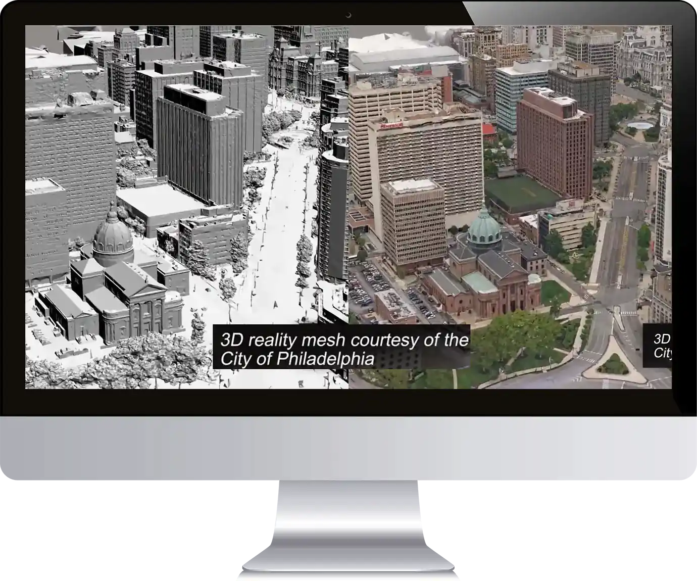
The use of AI and ML technologies in ContextCapture helps to improve the accuracy and efficiency of the photogrammetry process, allowing users to create accurate 3D models more quickly and easily than ever before. ContextCapture can be used by a wide range of professionals and organizations that need to create accurate 3D models from photographs. Here are some examples of who can use the software and take advantage of its AI capabilities:
- Surveyors: ContextCapture can be used by surveyors to create accurate 3D models of terrain and infrastructure, which can be used for planning and design purposes.
- Engineers: Engineers can use ContextCapture to create 3D models of existing structures, such as buildings and bridges, to aid in retrofitting and renovation projects.
- Architects: ContextCapture can be used by architects to create 3D models of buildings and sites, which can be used for visualization and design purposes.
- GIS Professionals: ContextCapture can be used by GIS professionals to create accurate 3D models of terrain and infrastructure, which can be used for mapping and analysis purposes.
- Construction Companies: Construction companies can use ContextCapture to create 3D models of construction sites and existing structures, which can be used for project planning and visualization.
- Government Agencies: Government agencies can use ContextCapture to create accurate 3D models of infrastructure and terrain, which can be used for planning, disaster response, and emergency management.
ContextCapture software is a photogrammetry solution that allows users to create accurate 3D models from photographs. The software uses a variety of advanced technologies, including artificial intelligence and machine learning, to streamline the photogrammetry process and improve the accuracy of the resulting models.
The photogrammetry process involves taking photographs from multiple angles and then using specialized software to create a 3D model of the subject. ContextCapture makes this process more efficient and accurate by automating many aspects of the process and using AI and ML to improve the quality of the model.
ContextCapture can automatically recognize and identify objects in photographs. This saves time and improves the accuracy of the model, as the software can automatically identify and map objects such as buildings, trees, and roads. Additionally, the software uses AI algorithms to create 3D models from photos, without the need for manual intervention. The software automatically processes the images, identifies common points, and stitches them together to create an accurate 3D model.
ContextCapture can classify point clouds using machine learning algorithms. Point clouds are collections of 3D points that represent the surfaces of objects, and the software can automatically classify points into different categories, such as vegetation, buildings, and terrain. This simplifies the process of creating accurate 3D models and improves the overall quality of the model.
ContextCapture includes advanced quality control features, which use AI to perform quality control checks on the 3D model. The software can automatically detect errors or anomalies and alert the user to potential issues, ensuring that the resulting model is accurate and free from errors.
It includes a variety of tools for manipulating and editing the 3D model, including tools for texture mapping, measurement, and editing. The software also includes a variety of export options, allowing users to export their 3D models in a variety of formats for use in other applications.

